

Lecture & MapLab
Redrawing Borders, Reimagining Cities
18 juni 2025
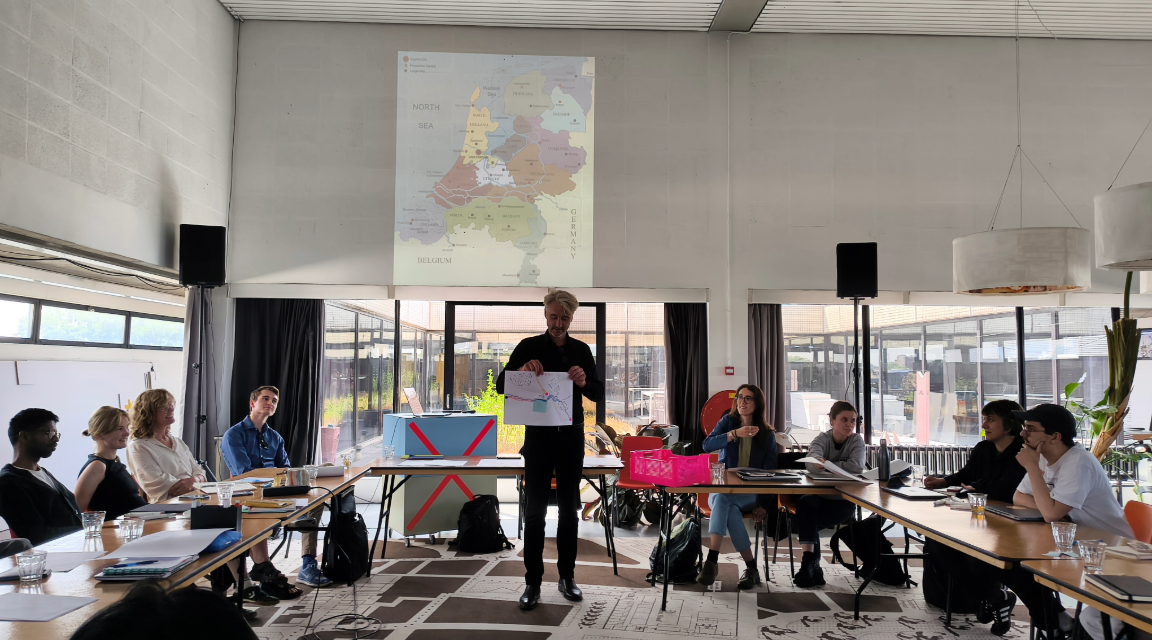
On Thursday 12 June, together with the Independent School of the City we hosted a compelling lecture and interactive MapLab led by Prof. Henk van Houtum, centered around his latest book Free the Map. Challenging the idea that maps are objective representations of reality, Henk van Houtum exposed how conventional cartography continues to reinforce outdated territorial thinking.
“What if everything we think we know about borders and cities is misleading?”
Traditional maps present countries as rigid containers and cities as anonymous dots. These visuals, born from colonial logic and perpetuated through standardized mapping conventions, reinforce a state-centered worldview: bordered territories, isolated cities, and “us vs. them” mentalities.
Van Houtum’s claim: this is not neutral representation—it’s a political act.
Key points from the lecture
Borders
- Borders are not fixed; they are fluid, socially constructed, and experienced differently across contexts.
- The “borderline trap” reduces complex zones of interaction into artificial lines of separation.
- Representing migration with arrows—especially thick red ones—creates fear-based narratives of invasion, ignoring human stories and global interdependence.
Cities as Dots
- Representing cities as dots implies isolation and homogeneity.
- In reality, cities are diverse, dynamic, and deeply interconnected in global flows of people, goods, and ideas.
- “Dot thinking” ignores the social, economic, and ecological entanglements between urban spaces.
Colonial Cartography Still Governs
- The Mercator projection, “logos” of countries like the Netherlands, and maps decorated with flags all stem from a colonial worldview.
- This thinking fuels nationalism, discrimination, and territorial essentialism.
“The map is a 16th-century lie we still live by.”
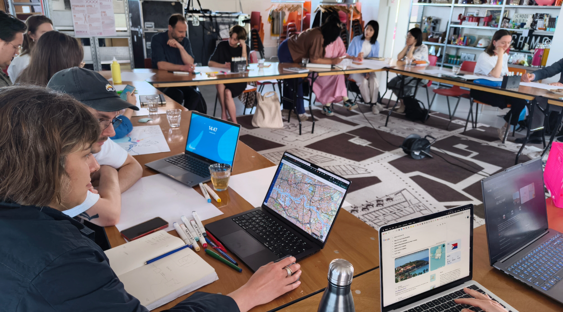
Prof. van Houtum didn’t stop at critique. He invited participants to draw differently:
- Relational Maps: Show economic ties, social networks, water flows, or data routes.
- Rotated/Decentered Maps: Flip perspectives to deconstruct “north” as default.
- Chrono-Maps & Isochrones: Represent space based on travel time or connectivity.
- Migration as Movement, Not Invasion: Use patterns that highlight mobility, not threat.
“Let’s replace dots with patterns, borders with flows, and containers with connections.”
Participants were invited to explore speculative cartography, mapping their own experiences of borders, movements, and places of connection.
This was not only a critique of traditional mapping but an invitation to imagine and create more inclusive, dynamic, and truthful maps—tools that help us understand how we actually live, move, and relate to one another
The Assignment
Create an intuitative map (on paper or digitally) of the Netherlands, incorporating the elements and aspects of life that you want to make visible of internal borderscapes (administrative barriers, migrant detentioncentres, etc) and/or multinationals, climate footprints, telecommunications (cables), international waterconnections, international fauna, EU legislations, joint Frontex border control, etc.).
Create a story or counterframe that explains the significance of the elements you have chosen, which are absent from a standard map. What is at stake?
Henk van Houtum
Prof. Dr. Henk van Houtum is a leading expert in border studies, serving as Professor of Political Geography and Geopolitics at Radboud University Nijmegen. He co-founded and directs the Nijmegen Centre for Border Research, where his interdisciplinary work explores the ethics and philosophy of borders, European geopolitics, and the cartography of borders and migration. His most recent book, Free the Map, advocates for a new visual language in representing borders and migration. Van Houtum is a frequent contributor to national and international media, offering critical insights on contemporary border issues.
Free the Map
A map is more than a tool—it is a proposition, a visual story we tell about the world and our place in it. Yet most maps still echo a single, outdated narrative: the world divided neatly into bordered nation-states. From school atlases to news graphics, this state-centric design—rooted in Mercator’s 16th-century projection for colonial navigation—continues to shape how we imagine space, identity, and power today. The world remains largely represented as state-appropriated territories, surrounded by static linear boundaries that envision homogeneous nation-states. Tellingly, the migration of ‘Others’ is predominantly represented as unidirectional arrows invading these state-containers. Read more here.
The consequence of this hegemonic representation is that, despite critical border and migration studies convincingly establishing that borders and migration are dynamic, relational processes, standard cartography systematically normalizes nationalism and nativism, and suppresses demographic diversity, international interdependencies, human experiences, and the complex socio-economic, technological and legal entanglements that shape geographical reality. In this book Van Houtum examines the profound impact of this visual regime and gives an overview of innovative artistic and cartographic counter-mapping practices that seek to humanize and mobilize the map. Free the map ends with a call to action. Various artists and cartographers offer exciting ready-to-use mapping challenges for education and public Maplabs. Order Here